 Last week’s storms slammed the length of California, dumping heavy rain, triggering floods and debris flows from the Coast Range to the Sierra and through the Transverse Range all the way to the tip of the Peninsular Mountain Range.
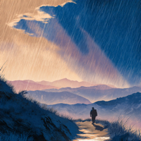
The Southern California stretch of the Pacific Crest Trail — a place near and dear to my heart; I live here and have section-hiked the PCT for years — took an especially hard hit, with trailheads, road approaches, water crossings, and low camps dragged or buried by mud and runoff. That stretch changes from low desert washes and sage-and-chaparral foothills up into oak and mixed-conifer slopes on the San Gabriel and San Bernardino ridgelines, then climbs into the higher San Gorgonio and San Jacinto country where pinyon, fir, and true montane/subalpine stands hold late snow. Expect everything from loose, rocky tread and brushy switchbacks to steep gullies that channel flash runoff — which is precisely the kind of terrain that turns a heavy storm into road-and-trail damage in a hurry. Post-storm, gateway towns are digging out, businesses and volunteers are scrambling, and land managers are triaging access and safety across the corridor.
Continue reading →


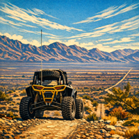 United States District Court Orders OHV Route Closures in the West Mojave Desert
 The MAPWaters Act has cleared Congress and is headed to the President’s desk.
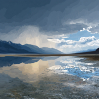 A string of storms this fall left Death Valley doing what it rarely does: collecting rainwater.