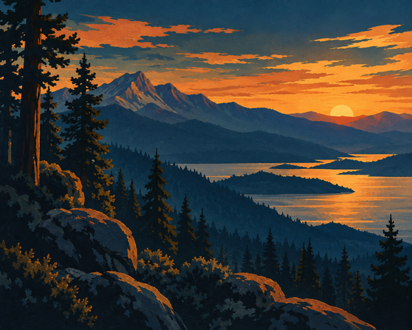

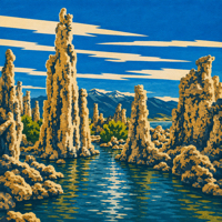
 Mono Lake covers 65 square miles in California’s eastern Sierra Nevada. It’s more than a million years old, has no outlet, and holds no fish. It does hold trillions of brine shrimp, calcium-carbonate towers rising straight out of the water, and enough migratory birds each year to rank among the most important stopovers in the West.
The lake sits off Highway 395, 13 miles east of Yosemite, just outside Lee Vining.
Getting There: Highway 395 and Lee Vining
Lee Vining is the closest town and the place to stock up on gas, food, water, and anything else you’ll need before heading around the lake. From there, Highway 395 and Highway 120 East provide access to the lake’s major visitor areas.
Each access point has its own turnoff. South Tufa and Navy Beach share a turnoff from Highway 120 East, about 5 miles past the Highway 395 junction. Keep left at the fork in the dirt road for South Tufa and right for Navy Beach. Panum Crater is a few miles farther down Highway 120 East, reached by a short dirt access road. Old Marina sits 1 mile north of Lee Vining, right off Highway 395. Mono Lake County Park is 5 miles north of town on Cemetery Road.
The Mono Basin Scenic Area Visitor Center is just north of Lee Vining on Highway 395, overlooking the lake. Start there if you can. The visitor center operates seasonally and hours vary, so call ahead before making the drive: (760) 647-3044.
Spring and Fall for the Birds, Winter for the Quiet
Spring and fall bring mild weather, fewer people, and the best chance of catching the lake’s migratory birds passing through. Summer brings the most visitors and the busiest schedule of naturalist-led programs at South Tufa.
Access narrows in winter. The visitor center closes for the season, Highway 120 East closes beyond the winter closure point, and the South Tufa road isn’t plowed. The lake gets quieter, snow settles on the tufa towers, and cross-country skiing becomes possible around South Tufa, Navy Beach, and Old Marina when conditions allow.
Weather shifts quickly here, regardless of the season. Layers aren’t optional.
South Tufa: The Reserve’s Largest Grove
South Tufa has the largest concentrated grove of tufa towers at the lake. If you only have time for one stop, this is it. A 1-mile, self-guided interpretive loop leads from the parking area to the shore and through the towers. There’s no shade anywhere on the trail, so bring a hat and water.
Naturalist-led walks are offered seasonally, with the most frequent schedule between Memorial Day and Labor Day. The self-guided trail is available whenever the area is open.
Entry is $3.00 per person, ages 16 and up; younger visitors enter free. Because South Tufa is a federal fee area, qualifying America the Beautiful and other interagency passes are accepted. Payment at the fee station is cash only and runs on the honor system, but don’t mistake that for optional. Rangers and county deputies do check.
Navy Beach: Kayaks, Canoes, and a Gentle Slope
Navy Beach is one of the easiest places to put a kayak, canoe, or paddleboard into Mono Lake, thanks to a small parking area close to the water. The soft beach and gentle slope also make it a popular swimming spot. A short trail connects Navy Beach to South Tufa.
The Mono Lake Committee also runs seasonal canoe tours from Navy Beach, giving visitors a water-level view of the tufa, brine shrimp, birdlife, and the lake’s unusual chemistry.
Panum Crater: The Youngest Volcano in the Chain
Panum Crater is the northernmost and youngest vent in the Mono Craters chain. It formed during an eruption about 600 years ago, while the volcanic chain itself was built by repeated eruptions spanning roughly 40,000 to 600 years ago.
Two trails cover it: a longer rim trail through soft sand around the crater’s edge and a shorter climb into the crater and onto the plug dome, where views open across the Mono Basin.
Old Marina: Pumice-Block Tufa and Island Views
Old Marina is one of the quickest ways to get from Highway 395 to the edge of Mono Lake. Its tufa looks different from South Tufa’s for a reason. When Negit Island erupted, pumice floated across the lake and lodged along the shore, where the same calcium-carbonate reaction responsible for the lake’s towers formed tufa around the pumice itself.
The David Gaines Memorial Boardwalk runs through the area, with views across the water toward the lake’s islands. A day-use fee applies, and pets aren’t allowed on the boardwalk.
Mono Lake County Park: Boardwalk Closed Below the Park
Mono Lake County Park offers picnic tables, restrooms, a playground, and shade beneath mature cottonwoods, making it one of the more comfortable places around the lake to stop for lunch.
Normally, a trail and boardwalk continue through willows and marsh toward the lakeshore, providing excellent birding along the way. The boardwalk below the park is currently closed until further notice, however, following damage from the Inn Fire. The park’s lawn, picnic area, playground, and restrooms remain open.
Dogs aren’t allowed at County Park or on the State Reserve boardwalk.
The Visitor Center: A Film, Two Galleries, and a Bird Board
The U.S. Forest Service’s Mono Basin Scenic Area Visitor Center sits just north of Lee Vining on Highway 395, overlooking the lake. Inside are exhibits on the natural and human history of the Mono Basin, a 20-minute film, two art galleries, and a bookstore. A bird-sighting board is updated regularly with what’s being seen around the basin.
Outside, an interpretive trail begins behind the building and descends toward the lake, with broad views across the basin along the way.
Lee Vining: Home Base
Lee Vining is the nearest town and the practical home base for exploring Mono Lake. Motels, restaurants, gas, groceries, and other basic services are all here.
The Mono Lake Committee operates an Information Center and Bookstore downtown, which also houses the Lee Vining Chamber of Commerce. The Mono Basin Historical Society Museum is worth a stop, too, particularly if you want context on the people, mining camps, ranches, roads, and water battles that shaped the basin.
Boating Restrictions, No Drones, and No Climbing the Tufa
Boating is permitted on Mono Lake, including motorized watercraft, kayaks, canoes, and paddleboards. Wildlife-protection closures are strict, though. From April 1 through August 1, boats must remain at least one mile from the lake’s islands and islets to protect nesting gulls. From April 1 through September 1, boats, paddleboarders, and other lake users must stay at least 200 yards from osprey nests on offshore tufa towers.
Drones are prohibited over the lake surface and state-managed shoreline without a special-use permit.
Don’t climb or stand on the tufa formations. Tufa forms underwater where calcium-rich freshwater meets the lake’s carbonate-rich water. Once a tower is exposed above the surface, it stops growing, which means damage to the formations you see today can’t simply repair itself.
Swimming is permitted in Mono Lake. The water is about 2.5 times as salty as the ocean, making swimmers unusually buoyant, but keep it out of your eyes and away from cuts. It stings.
Camping Nearby: Lee Vining Canyon and Lundy Canyon
There are no developed campgrounds inside Mono Lake Tufa State Natural Reserve or the Mono Basin National Forest Scenic Area. Nearby, Lee Vining Canyon has several Forest Service campgrounds along Highway 120 West, including Lower Lee Vining, Moraine, Cattleguard, Aspen, Big Bend, Junction, and Saddlebag Lake. Availability, opening dates, fees, and reservation policies vary by campground and season, so check current Forest Service information before heading up the canyon.
Lundy Canyon has its own county-run campground with first-come, first-served sites. Don’t confuse it with Lundy Lake Resort next door, a private operation with its own accommodations and reservation system.
Dispersed camping is permitted in much of the surrounding Scenic Area, but not on the exposed lakebed. Campers are responsible for knowing current fire restrictions and where dispersed camping is permitted. A California Campfire Permit is required for campfires, barbecues, and portable stoves outside developed campgrounds when fire restrictions allow their use.
Who to Call
Mono Lake Tufa State Natural Reserve (California State Parks): (760) 647-6331
Mono Basin Scenic Area Visitor Center (U.S. Forest Service): (760) 647-3044
Mono Lake Committee Information Center and Bookstore: (760) 647-6595
A Million Years in the Making
Mono Lake has no outlet. Everything that flows into it eventually leaves through evaporation, concentrating the salts and minerals left behind. Over more than a million years, that’s made the lake roughly 2.5 times as salty as the ocean.
The tufa towers form where calcium-rich freshwater springs push up through the lake’s alkaline, carbonate-rich water. The reaction precipitates calcium carbonate around the springs, slowly building towers beneath the surface. Many of the formations visible today were exposed only after the lake level fell.
That drop wasn’t only geological. Beginning in 1941, Los Angeles began diverting water from the streams that feed Mono Lake. By 1982, the lake had fallen about 45 vertical feet, from roughly 6,417 feet above sea level to an historic low near 6,372 feet.
The Mono Lake Committee, National Audubon Society, and others spent years fighting the diversions in court and before state regulators. In 1994, the State Water Resources Control Board issued Decision 1631, restricting diversions and establishing a long-term management level of 6,392 feet.
More than three decades later, Mono Lake still hasn’t reached that target. Drought, climate change, and continued water diversions have complicated its recovery, making the lake not only a remarkable piece of California’s natural history but an ongoing chapter in the state’s long argument over water.
Bring water, a hat, and cash for the fee box. Conditions, road access, programs, fees, and closures change with the season – CLICK HERE to check current conditions before you head out.