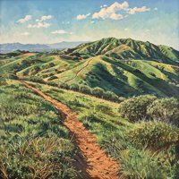
Located on the very eastern edge of the city of Orange, Santiago Oaks Regional Park runs alongside Santiago Creek, Orange County’s main tributary to the Santa Ana River.
This secluded 1,269 acre park – located close enough to most east Orange neighborhoods to walk to, including Orange Park Acres and Villa Park – offers family-friendly nature well within the reach of everyone. There is a mature forest, Santiago Creek, wildlife, and trails for virtually every level of hiker, mountain biker, and equestrian.
Unlike nearby Irvine Regional Park, Santiago Oaks is less of an ‘entertainment’ destination park; you won’t find a zoo, trains, or large open maintained grass areas for parties. It’s a wilderness park. Santiago Oaks calls to the adventurer’s spirit within; the park does offer a cozy amphitheater, BBQs, picnic tables, playgrounds, and an interpretive programs/nature center, but the draw – the beauty – of Santiago Creek are the trails. A vast interconnected series of trails stretch throughout the park offering technical trails for all skill levels, and rewarding the hiker, biker, or equestrian with inspiring views of Orange and the unspoiled foothills surrounding the city. The park trails also connect with the Anaheim Hills Trail System.
Continue reading →

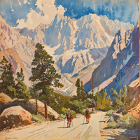
 2020 was a difficult year for travelers, wanderers, adventurers, and explorers here in California. I did get out – sometimes with groups, sometimes furtively by myself – and was rewarded with solitude, silence, and freedom within the great cathedrals of nature that California offers from the deserts to the beaches, to the mountains and deep forests.