
 Press release from the U.S.D.A.:
The Stanislaus National Forest will be hosting two open houses on Friday, December 13 from 2 p.m. to 7 p.m. and Saturday, December 14, 9 a.m. to noon at the Stanislaus National Forest Supervisor’s Office (19777 Greenley Road, Sonora, CA 95370).
“We invite the public and stakeholders to the open houses to provide an opportunity to visit with staff regarding the Rim Fire proposed Environmental Impact Statement (EIS) project details, and the National Environmental Policy Act (NEPA) process. It offers those with questions on how to comment prior to the end of the public comment period that begins on December 6, 2013, and ends on January 6, 2014,” Maria Benech, Rim Fire Recovery ID Team Leader said.
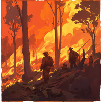 A deer hunter — not pot growers, as some politicians with an agenda publicly stated — started the Rim Fire that burned through over 237,341 acres of land in the Stanislaus National Forest and Yosemite National Park before firefighters finally got the upper hand. The 402 square mile fire blazed through more than $127 million of taxpayer money just fighting it. It began in the steep hills of the remote Jawbone Ridge area to the east of Groveland on August 17, 2013 and quickly spread out of control. Losses are estimated to be in excess of $50 million.
 As the holidays get close, and the air cools off a bit (yep, I’ve already dug out my flannel-lined jeans!) don’t forget our California State Parks. CalParks Park Champions program operates year round to help restore the natural ecosystems in state parks or assist with much needed general maintenance projects.
 Mary Forgione, the Los Angeles Times’ Daily Deal and Travel Blogger has written an article about winter vacation deals in Utah and California. It turns out that there are some great weekday deals in and around our national parks. In California, for example, Sequoia & Kings Canyon national parks have fewer visitors, snow, and low prices!
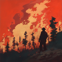 Press release from the USDA: