
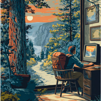
 On Wednesday, Google launched a collection of images from more than 44 national parks and historic sites across the United States and Canada after travelling through the destinations earlier this year.
From Google Maps Product Manager, Evan Rapoport:
What do tents and hiking boots have in common? You don’t need either to start exploring or planning your next adventure to some of the best national parks and historical sites across North America.
Working with the U.S. National Park Service and Parks Canada, our Street View cars, trikes and Trekkermapped more than 44 locations with beautiful, 360 degree panoramas.
 Apparently I’ve been going to the wrong forests; I NEVER leave any of the places I hike in looking for Cheetos and pizza! I guess I’d better head up to Inyo!
 The Plumas National Forest is planning to conduct a number of prescribed burns this fall to reduce hazardous fuels, and improve ecosystem health. Planned projects include burning piled materials, low to moderate intensity understory burns of vegetation on the forest floor, and moderate to high intensity broadcast burning of brush. The goals of these projects are to reduce the severity of future wildfires and provide added protection for communities in the wildland urban interface, to promote more diverse and resilient ecosystems, and improve habitat for wildlife.
 Based on changing weather trends, increases in relative humidity and a decrease in average temperatures, the Sierra National Forest is lifting the fire restrictions that were put in effect July 2.